UPDATE #1- SEVERE WEATHER: Monday, June 26th, 2023 from 5 p.m. to 9 p.m. and again Tuesday, June 27th, 2023 from 12 a.m. to 2 a.m.
Date Posted: Monday, June 26th, 2023This afternoon’s severe thunderstorm potential is mainly between 5 to 9 pm and again between Midnight and 2 a.m. Tuesday. There is also a chance of Showers and/or Thunder Storms on Tuesday and Wednesday afternoon this week.
***Due to the expected high winds, residents are encouraged to secure all outdoor furniture, trash cans, play equipment, basketball hoops, etc. ***
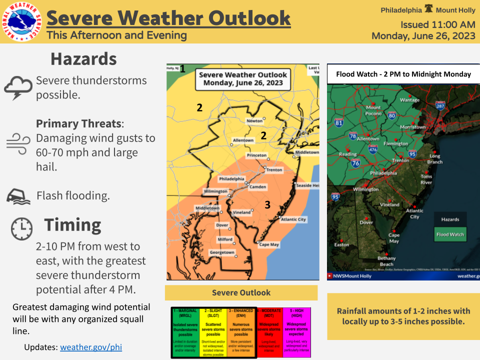
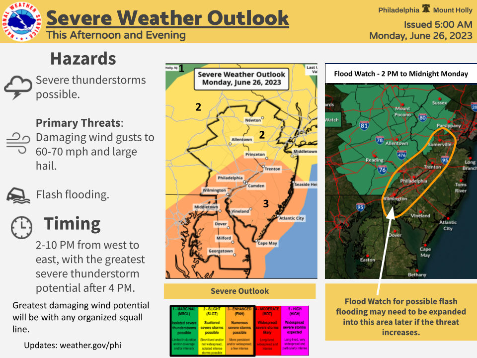
Changes: A Flood Watch for the potential for flash flooding has been issued for parts of Eastern PA and Northwestern NJ (2 p.m. to Midnight tonight). Our entire region is now in a slight or enhanced risk for severe thunderstorms (levels 2 and 3 out of 5).
Severe thunderstorms are probable across our area this afternoon and evening. Damaging winds, large hail, and flash flooding are the primary threats, and there is a low chance of a tornado. Some showers and storms this morning will give way to a break, then more numerous thunderstorms are expected later this afternoon and evening. The greatest damaging wind potential will be with any organized squall line that develops.
Hazardous Weather: Severe thunderstorms and flash flooding.
Locations affected: Eastern PA, NJ, DE, and northeastern MD.
Timing: This afternoon and evening, approximately 2-10 PM, with the greatest severe thunderstorm potential after 4 PM.
Impacts: Damaging wind gusts to 60-70 mph, which will damage trees and power lines, and large hail. Excessive rainfall rates could result in flash flooding, especially in urban areas. The tornado potential is low. Storms should produce frequent cloud to ground lightning.
Confidence on occurrence: High confidence thunderstorms occur, but lower confidence on how organized storms will be along with the specific timing details.